
Overview | Suggested trips | Navigation guide | Access points | River gauges | Additional resources
Google Earth file (.kmz) | Condensed notes (.docx)


Overview
The birthplace of the Chemung River is an interesting spot. At low water, the confluence of the Tioga and Cohocton is possibly the shallowest area of the entire Chemung, its jumble of shoals constantly shifting as competing currents reshape the riverbed. After heavy rainfall, the steeper, rockier Cohocton clarifies quickly, while the large volumes of water dumped by Tioga Lake scour the downstream river’s softer banks, adding tonnes of sediment to the already turbid reservoir release. This contrast presents as a striking line of confluence between bluer, clearer Cohocton water and murky, yellow-brown Tioga water, which resist mixing fully for miles.
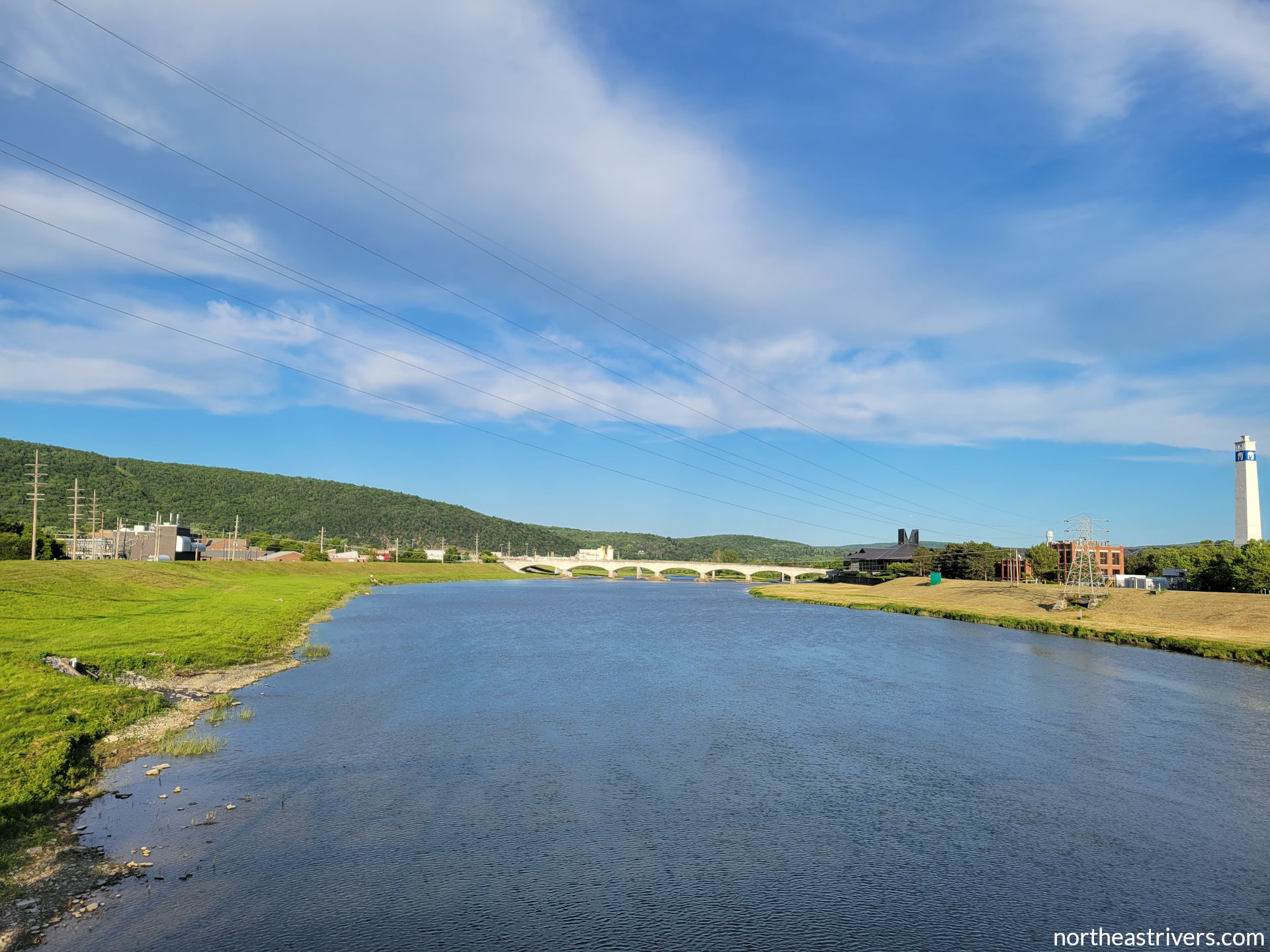
From these beginnings, the Chemung River meanders through the hilly farm country of New York’s Southern Tier, dancing back and forth along the state line until it dives into Pennsylvania for good to find the Susquehanna. It is by no means a wilderness river, never wandering far from I-86 as it bisects Corning and Elmira, two of the largest cities in an otherwise lightly populated region. However, its central location connecting those cities has facilitated the development of access points every five or so miles, an effort led by the Friends of the Chemung River Watershed (FCRW). With only gentle riffles and no true rapids, and just large enough to reliably run year-round, the Chemung is a convenient choice for beginners looking for a friendly river into which to dip a paddle.
The Chemung is the author’s home river. It is the river upon which she learned to negotiate moving water, the river she runs each spring to inaugurate the paddling season, and the first river she paddled from end to end in a single day. Although the Chemung may be middling among rivers of the Northeast in its scenery and water quality, it will always hold a special place in the author’s heart.
This guide covers the entire length of the Chemung River, from source to mouth.
Source: Tioga River and Cohocton River at Painted Post, NY
Mouth: Susquehanna River at Athens, PA
Mapped length: 45.7 miles
Average gradient: 4 ft/mile
Difficulty: class I-
Significant hazards: low-head dam at Elmira (27.1); strainers around the islands at the foot of the Palisades (33.9)
Suggested trips
Short: Bottcher’s Landing to Fitch’s Bridge
Length: 6.4 miles
Difficulty: class I-
Significant hazards: strainers around 33.9 islands
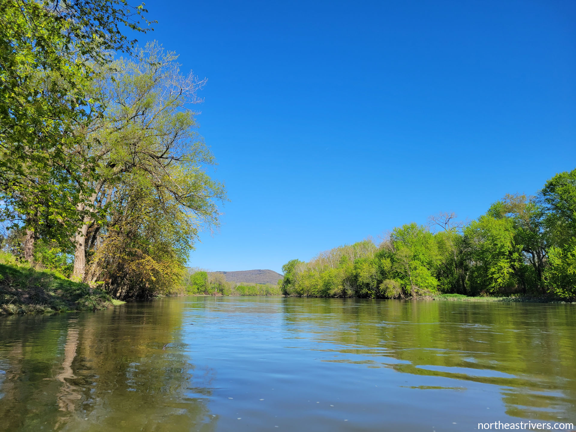
The low but sheer cliff across from Bottcher’s Landing offers a glimpse of what is to come on by far the most isolated stretch of the Chemung. Roads keep their distance from the river as it flows swiftly through island mazes; even cell service is hard to come by in the valley here, hemmed in as it is by nearly thousand-foot slopes on both sides. Midway through this short paddle, the iconic Palisades loom over river-right, their ruffled face verdant in summer and gold-speckled in autumn. On fair-weather days, sailplanes departing Harris Hill gliderport north of the Palisades can be spotted soaring above the river.
Medium: Kinsella Park (Cohocton River) to Bottcher’s Landing
Length: 10.4 miles
Difficulty: class I-
Significant hazards: none
This urban section of river begins on the channellised Cohocton; bouncy waves under the interchange bridges just before the confluence are more significant than any riffle on the Chemung. Corning as viewed from the water is basically attractive, with its historic district’s stately houses peering from the southside hills and the angular panels of Corning Glass headquarters gleaming in the sunlight. Those looking for more nature and less city in their paddling will find it in the final two miles, once the river has managed to gather some distance from Corning and the highway.
Long: White Wagon Rd to Bridge St (Susquehanna River)
Length: 13.7 miles
Difficulty: class I-
Significant hazards: none
I-86 peels away from the Chemung River shortly past White Wagon, the former continuing east along the banks of the Susquehanna River while the latter winds south to meet the Susquehanna at its own place and on its own time. This lowermost section of the Chemung is peaceful if not quite remote, the Athens waterfront unobtrusive and the landscape pleasant as the river departs the broad floodplain of Sayre and the valley walls close in. The trip concludes with a delightfully serene five miles on the Susquehanna to the first take-out at Ulster.
Navigation guide
| River mile | Type (key) | Description | Links |
|---|---|---|---|
| 45.7 | The Tioga River on the right and the Cohocton River on the left join to form the Chemung River at the village of Painted Post, named for a Native American artifact marking this meeting of waters. | confluence pic | |
| 45.3 |   |
Cutler Creek, whose final mile has been heavily modified to protect Corning and Riverside from flooding, terminates at a drop structure with two outlet gates at river-left. | Cutler Creek pic |
| 44.8 |   |
The Denison Pkwy West (Rt 352) bridge crosses the channel obliquely. | bridge pic |
| 44.7 |   |
A collection of small gravel bars coalesced around the ruins of old bridge piers; deepest passages are at centre and centre-left. | |
| 44.3 |   |
Hillvue Park access on the left, at the base of Corning’s grassy levee. From the river, look for a pavilion atop the crest. | access map |
| 44.1 | |
An aesthetically pleasing through truss bridge carries aptly-named Bridge St across the river. | bridge pic |
| 43.9 |  |
The green-painted Corning gaugehouse is sited on the sloping right bank levee. | gaugehouse pic |
| 43.7 |   |
|
bridge pic |
| 43.6 | |
Brisco Bridge (Centerway, Rt 414) crosses at an angle immediately downstream of the Centerway pedestrian bridge. | |
| 42.9 | |
Conhocton St access on the right, an extremely muddy shore on the inside of a wide right bend. As of spring 2022, FCRW is in discussions with the City of Corning and the DEC to improve this access. | access map |
| 42.8 | |
Post Creek enters from the left as the river completes its southward turn and begins to hug I-86. | Post Creek pic |
| 42.5 | |
Two low-lying, scrubby islands; go left of the first and on either side of the second. | islands pic |
| 42.4 |   |
Scattered remnants near the right shore and a stone crib abutting the second 42.5 island recall the 19th-century dam that watered the Chemung Canal, which connected the river to Seneca Lake. Any turbulence over the rubble is smoothed into uniform waves at moderate flows, but at low water it is best to stay clear and keep close to the island if taking the right channel. | obstructions map |
| 42.3 | |
Mouth of Narrows Creek on the left, a rocky little stream ending at a large gravel bar. | |
| 42.1 | |
|
bridge pic |
| 42.0 | |
Four stubby wing dams poke into the channel from the left shore. | |
| 41.7 | |
Bar on the left, partially inundated at normal water levels; the deepest route here can be found at centre-right. | |
| 40.8 | |
Whisky Creek empties into the river at a marshy flat on the right. | |
| 40.6 | |
A couple of bars at right and centre-right; keep left. | |
| 40.4 | |
Another brushy bar, this one attached to the left bank; keep right. | |
| 40.3 | |
The ghostly footprints of two former bridge piers are shallowly submerged at average water levels. | |
| 39.9 | |
River Rd (Rt 44) access on the right, a set of steps leading up the bank that is not readily apparent from upstream. The FCRW information kiosk located at this access is easier to spot from the river. | access map |
| 39.0 | |
Both channels around this meander cutoff island are easily passable. If taking the right channel, keep right to avoid a jagged line of shoals; if taking the left channel, keep right at a second island beginning just past the head of the first. | islands pic |
| 38.5 | |
Diminutive Gillette Creek on the right is easy to miss. | |
| 38.2 | |
The channel divides and subdivides around a complex cluster of islands stretching for 0.6 miles; main channel is right-centre-right. | islands pic | map |
| 37.0 | |
South Corning Rd (Rt 10) bridge | bridge pic |
| 36.8 | |
Bottcher’s Landing access on the left, an excellent though occasionally muddy concrete ramp 500 ft below the Rt 10 bridge. | access pic | map |
| 36.4 | |
A long crescent-shaped island wraps around the inside of a right bend. Take the main (left) channel for Minier’s Field access. | |
| 36.3 | |
Steer clear of a line of boulders extending diagonally from the left bank. | |
| 36.0 | |
Winfield Creek skirts a golf course and drains into the river on the left. | |
| 35.8 | |
Minier’s Field access on the left in the left channel around 36.4 island, a concrete ramp at the mouth of an inlet that becomes a little side channel at high water. This ramp will be covered in a thick layer of mud if it has not been shovelled recently; Bottcher’s Landing one mile upstream is usually a better option. | access pic | map |
| 34.3 | |
A small gravel bar in the centre of the channel is constantly being moulded by the powerful currents bearing upon it. As of spring 2021, there is good passage on either side. | |
| 33.9 | |
CAUTION! The channel braids around a mass of islands as the Palisades tower over the right bank. This spot is notorious for having been the site of several strainer run-ins, one fatal. There are a multitude of side channels that open up as the water gets higher, but they are narrow, sinuous, and strainer-prone. Happily, the main channel to the right of all islands has straightened out in recent years and no longer involves a blind turn. Take this channel and stay alert. | islands pic | map |
| 33.7 | |
Sing Sing Creek comes in from the left, in the far left channel around the mess of 33.9 islands. | |
| 33.0 | |
Another string of islands, these continuing for 0.9 miles. Main channel is to the right of the first island, then centre between a pair of islands about a quarter mile down. | islands map |
| 31.7 | |
A grassy bar at a widening of the river; deeper water on the right. | |
| 31.4 | |
Bar and shallows on the right; keep left. | |
| 30.9 | |
Yet another low scraggly bar on the left; keep right through a bouncy riffle. | |
| 30.5 | |
Hendy Creek joins the river from the right, its gravel deposit gradually encroaching into the channel. | |
| 30.4 | |
|
access map |
| 30.3 | |
Islands extending 0.7 miles; take the left channel around the first, then either channel around the small, scrubby second. | |
| 30.1 |  |
A sharp right bend in the left channel around the second 30.3 island. As always when navigating sharp turns, beware of strong current pushing into a cut bank. | |
| 29.4 | |
Three pier remnants of the Rorick’s Glen bridge, one of many Chemung River bridges swept away in the devastating Hurricane Agnes flood of 1972. | bridge pier pic |
| 29.0 | |
Pirozzolo Park access, a good concrete ramp on the left. This is a well-appointed Town of Elmira park with a swimming pool, ballfields, and a riverfront trail that stretches to the Walnut St bridge. | access map |
| 27.5 | |
Hoffman Brook, buried under five city blocks, resurfaces to meet the river on the left. | |
| 27.4 | |
|
access map |
| 27.3 | |
Large, marshy Clinton Island; main channel right. Do not take the left channel at high water, as the dam immediately follows. Look for an osprey nesting pole near the foot of the island. | |
| 27.1 |  |
CAUTION! Chase-Hibbard Dam spans the river just downstream of Clinton Island. Land on the right at the “take out now” sign 100 ft above the dam and portage via a paved trail that leads 400 ft below. The portage points are also accessible from shore via the parking lot at the intersection of Main and Chemung. | |
| 27.0 | |
A cluster of low-lying gravel bars litters the channel; best passage is to the right of all. If you for some reason venture over to the other side, beware a submerged concrete obstruction at centre-left 300 ft below the dam. | |
| 26.9 | |
Main St bridge | |
| 26.7 | |
Norfolk Southern railroad viaduct, followed closely by the Clemens Center Pkwy (Rt 14) road bridge. | |
| 26.6 | |
The Elmira gauge stands atop the flood control works on the right. | |
| 26.5 | |
The Lake St bridge is today a newly-restored pedestrian crossing. As the only Elmira bridge over the Chemung to survive the flood of 1972 intact, all cross-river traffic was routed via Lake St until repairs could be made to the Madison Ave bridge. | |
| 26.4 | |
Elmira’s furthest downstream bridge carries Madison Ave over the river. | |
| 25.7 | |
Keep left at a treeless island as the river departs the city southbound; the right channel is nearly dry at low water. Another osprey nesting pole stands at the island’s downstream tip. | |
| 25.5 | |
Mouth of Newtown Creek on the left, in the left channel around 25.7 island. | |
| 25.2 | |
Dunn Field access on the right, a good concrete ramp just past the foot of 25.7 island. | access map |
| 24.4 | |
The Chemung County wastewater treatment plant discharges its effluent via a surprisingly pretty cascade of strongly chlorine-scented water at river-right. At low summer flows, the sluggish pool below the plant can get a little gunky. | outlet pic |
| 22.8 | |
A small island; main channel left | |
| 22.7 | |
Coldbrook Creek comes in on the right, behind the bar trailing the foot of 22.8 island. | |
| 22.3 | |
Seeley Creek, the Chemung’s longest tributary, enters the river from the right. The blue-green tint of the creek’s water is plainly visible at low flows. | Seeley Creek pic |
| 21.2 | |
Large Baldwin Island stretches for over a mile. The main channel is to the left, but the right channel is also decently deep and offers a quieter, more sheltered passage. | |
| 19.8 | |
A woody yet very low-lying island; main channel on the left. The right channel is usually a mess of strainers; avoid if you do not wish to become like spaghetti in a colander. | |
| 19.2 | |
Bentley Creek, another major tributary, joins on the right, its broad gravel deposit constricting the channel against the left bank. | |
| 18.9 | |
The Lowman Crossover bridge connects Wellsburg on the right shore to Lowman on the left. As of February 2022, the bridge was under construction; partial channel blockages are possible. | |
| 18.8 | |
Toll Bridge Park access, a concrete ramp on the left 350 ft below the Lowman Crossover bridge. Like so many others on the Chemung, this ramp is prone to accumulating mud, but the tabular rocks surrounding it offer alternative launching and landing spots. | access map |
| 18.4 | |
Do not be deceived by the wide left channel around this island, as it is quite shallow and often impassable. At low to moderately low water, take the narrower right channel. | |
| 17.7 | |
A small gravel bar in the middle of the river, with passage over a tilting cobbled bottom on both sides. | |
| 17.6 | |
Mouth of Baldwin Creek on the left, a sizeable stream that has its source in Breesport. | |
| 17.1 | |
A large, forested island hugs the left shore for 0.7 miles; navigate around the couple of gravelly islands in the right (main) channel as water levels permit. | |
| 16.0 | |
Another island; main channel right | |
| 15.8 | |
The first of four pairs of I-86 bridges over the Chemung straddles 16.0 island. | |
| 14.9 | |
The wider channel around this island is on the left, though the right channel is just as deep. | |
| 13.5 | |
Piles of concrete blocks under both spans of a Norfolk Southern rail bridge have matured into gravel bars; keep close to either shore. | bridge pic |
| 13.3 | |
Second set of I-86 double bridges | |
| 12.9 | |
The head of a brushy bar extends far out into the river and compresses the flow hard against the right; watch for strainers at the constriction. | |
| 12.4 | |
access map | |
| 11.9 | |
A gravelly island followed closely by a more substantial wooded one. The main channel is on the right with a nice riffle, but the left channel is just fine as well. | |
| 11.8 | The Chemung River enters Pennsylvania at the foot of 11.9 islands, though it will not remain there for long. | ||
| 9.9 | |
Yet another I-86 crossing looms behind a group of islands stretching for 0.5 miles and spanning two states. Take the centre channel around the first set of islands and the left channel around the second island, which begins under the bridges. | islands map |
| 9.6 | The river crosses back into NY immediately upstream of the first bridge. | ||
| 9.5 | |
Pass between the second and third piers (from the left) of the I-86 double bridges; the leftmost passage leads to shoals at the mouth of Wynkoop Creek. A strong rightward cross-current flows in the gap between island and bridge; angle left to avoid getting pinned against the third pier. | bridges pic |
| 9.4 | |
Wynkoop Creek drains into the river on the left, in the left channel around the second 9.9 island; continue keeping right. | |
| 8.8 | |
Usually-watered Dry Brook comes in from the left at an expanse of shallows. | |
| 8.5 | |
White Wagon Rd (Rt 56) access, an excellent concrete ramp on the right. Boasting a pavilion with picnic tables and a full-service restroom, this is one of the nicest access points on the river. | access map |
| 8.3 | |
A very low and nearly barren gravel bar lies close to the left bank. | |
| 7.4 | |
A stub of a pier in the centre of the channel is all that remains of the White Wagon bridge, another lost in the flood of 1972. | |
| 7.3 | |
Good passage may be found on both sides of an island in the middle of the river. Take the right channel for a riffle with nice standing waves near the foot of the island. | |
| 6.9 | |
|
obstructions map |
| 6.8 | The Chemung River departs NY, not to return this time as it continues flowing south through Pennsylvania. | ||
| 5.8 | |
Mile Lane Rd (Rt 4020) bridge | |
| 5.7 | |
Tozer’s Landing access, a concrete ramp on the right 350 ft downstream of the Rt 4020 bridge. The ramp is located in a small cove and is often buried under quite a bit of mud. A strong riffle at a right bend and constriction just below the access is probably the choppiest water on the lower Chemung; take care not to get pushed into the left bank. |
access map |
| 3.8 | |
The flat strip of land at the foot of Round Top breaks off into a large island; main channel to the left. | |
| 3.7 | |
Mouth of Tutelow Creek on the right, in the right channel around 3.8 island. | |
| 3.0 | |
Rt 220 bridge | |
| 2.9 | |
A Lehigh Valley Railroad bridge subtly arcs across the river. Use caution for an obstruction, roughly flush with the surface at average water levels, on the right just upstream of the bridge. | bridge pic |
| 2.1 | |
The Rt 199 bridge makes the last road crossing of the Chemung. It was here, at the narrow neck of Tioga Point where the Chemung and Susquehanna Rivers are separated by mere hundreds of feet, that the Native Americans portaged their canoes between the rivers. | |
| 0.8 | |
Murray Creek enters at a gravel bar on the right; keep well left to avoid shoals at the mouth. | |
| 0.5 | |
Little Wolcott Creek on the right is often dry during the dog days of summer. | |
| 0.4 | |
A small island; main channel on the right. The left channel is shallow but often passable, especially if the Susquehanna is high. | |
| 0.0 | The Chemung River empties into the Susquehanna River (mile 284.0) at the tip of Tioga Point. | mouth pic |

Access points
| River mile | Access (key) | Position | Nearest town | Type/condition | Links |
|---|---|---|---|---|---|
| 44.3 | Hillvue Park |
L | Corning, NY | poor grass/rock shore; steep overgrown bank | map |
| 42.9 | Conhocton St | R | Corning, NY | very poor mud/debris shore | map |
| 39.9 | River Rd (Rt 44) | R | South Corning, NY | map | |
| 36.8 | Bottcher’s Landing |
D/L | Big Flats, NY | excellent concrete ramp covered with mud | pic | map |
| 35.8 | Minier’s Field | L | Big Flats, NY | concrete ramp covered with deep mud | pic | map |
| 30.4 | Fitch’s Bridge (Hendy Hollow Rd, Rt 225) | D/L | West Elmira, NY | average mud/grass/gravel shore; short concrete ramp | map |
| 29.0 | Pirozzolo Park |
L | West Elmira, NY | good concrete ramp | map |
| 27.4 | Grove St | U/L | Elmira, NY | excellent concrete ramp | map |
| 27.1 | Chase-Hibbard Dam portage upstream | R | Elmira, NY | easy 600-ft portage over pavement/gravel/grass | map |
| 27.0 | Chase-Hibbard Dam portage downstream | U/R | Elmira, NY | excellent concrete ramp; good gravel/grass/debris shore | map 1 | map 2 |
| 25.2 | Dunn Field | R | Elmira, NY | good concrete ramp | map |
| 18.8 | Toll Bridge Park |
D/L | Wellsburg, NY | excellent concrete ramp covered with mud | map |
| 12.4 | Wyncoop Creek Rd (Rt 427) | M/L | Chemung, NY | very poor mud shore | map |
| 8.5 | White Wagon Rd (Rt 56) |
R | Waverly, NY | excellent concrete ramp | map |
| 5.7 | Tozer’s Landing |
D/R | South Waverly, PA | concrete ramp covered with deep mud | map |
River gauges
| Station | River mile | Data and forecasts | Recommended level |
|---|---|---|---|
| Chemung River at Corning | 43.9 | USGS | NWS | at least 15.5 ft |
| Chemung River at Elmira | 26.6 | USGS | NWS | at least 1.5 ft |
| Chemung River at Chemung | 12.4 | USGS | NWS | at least 3.5 ft |
Additional resources
Paddling outfitters: FCRW (through Endless Mountain Outfitters)
Guidebooks: Keystone Canoeing (Chemung to mouth) | Take a Paddle Finger Lakes (Painted Post to West Elmira; Elmira to Chemung)
Water trail map


See also: Chemung River watershed | Tioga River | Cohocton River | Middle Susquehanna River