
Overview | Suggested trips | Navigation guide | Access points | River gauges | Additional resources
Google Earth file (.kmz) | Condensed notes (.docx)

Overview
The West Branch Delaware River rises in the Catskills a mere eight miles from the source of the East Branch, at the divide between the Delaware and Hudson watersheds. Parallelled by NY Rt 10, the marshy slough winds leisurely through quiet farmlands, growing into a decent sized creek by the time it receives the Little Delaware River at Delhi. From there, the now mature pool-and-riffle stream continues westbound through an increasingly deep and steep-sided valley dotted with little hamlets; Delhi and Walton seem like metropolises by comparison.
A few miles past Walton, the river slows into the backwater of Cannonsville Dam. Completed in 1964 to slake New York City’s ever-growing thirst, its watershed covers the largest area among those of the City’s reservoirs. Like Pepacton Reservoir on the East Branch, Cannonsville employs a bottom release; however, due to its smaller capacity and higher inflow/outflow, it cycles more quickly and the bottom waters warm to around 15 °C (59 °F) by early autumn.
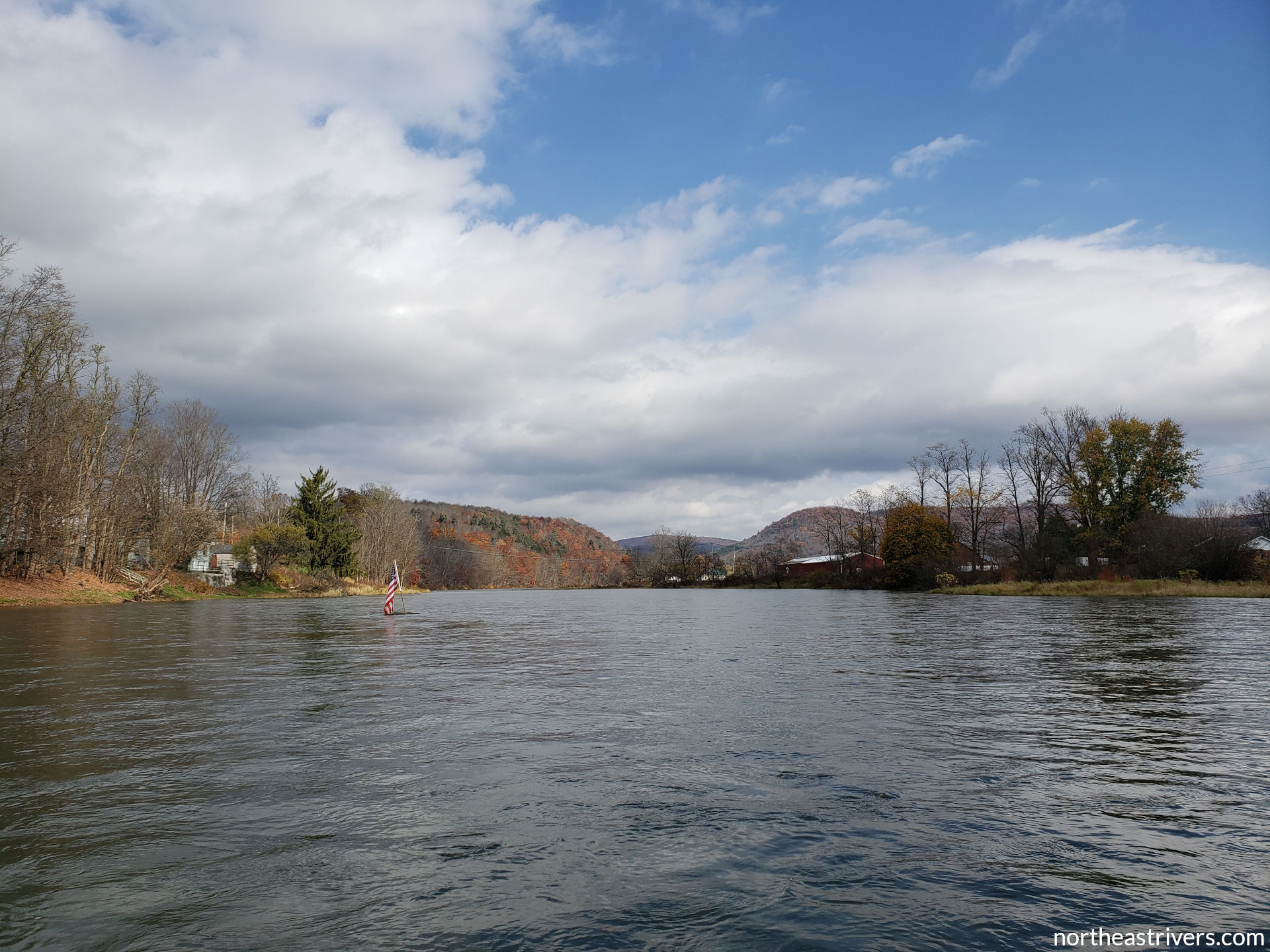
Below Cannonsville, the river turns southward through Deposit and then enters a narrow valley that would be nearly empty were it not for the highway and all the fly fishing activity. The scenery of sweeping hills and lush forests is still pleasant, and is especially beautiful in fall foliage season. The West Branch ends at Hancock, the “Gateway to the Upper Delaware”, where its waters join with those of the East Branch to begin a 330-mile journey on that great river, through Trenton and to the Atlantic.
Populated with native browns, rainbows, and brookies, the West Branch Delaware is perhaps the most famous trout stream in the Northeast. In addition to locals, many visitors flock to the West Branch from nearby cities to fish its productive waters, a trend that has only increased in recent years. Both wading and drift boat traffic can get quite heavy during prime fishing hours—sunrise and sunset, cloudy days, and weekends. At these times, the longer and less popular East Branch or the wide-open mainstem may be a more enjoyable paddle than the crowded West Branch. In any case, share the river and give anglers space by passing behind them when possible.
This guide covers the entire navigable length of the West Branch Delaware River below Cannonsville Dam, from Stilesville to the mouth.
Source: headwaters above Stamford, NY
Mouth: Delaware River at Hancock, NY
Mapped length: 17.0 miles
Average gradient: 6 ft/mile
Difficulty: class I
Significant hazards: cold water that persists all year, especially in the first few miles; angler traffic
Suggested trips
Short: Sherman Creek Rd to Balls Eddy
Length: 5.0 miles
Difficulty: class I-
Significant hazards: cold water; angler traffic
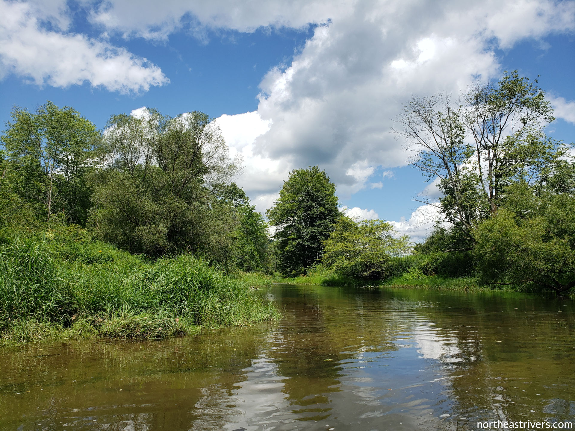
As the calmest section of an already quite calm river, this short segment is ideal for beginners. It offers a taste of the pretty, pastoral valley of the lower West Branch, where forested slopes loom over grassy islands and clear water (at low dam releases, anyway) slides smoothly over the cobbled riverbed. Sparser public accesses and warmer summer water temperatures mean this section sees marginally less fishing activity than the miles immediately below Deposit, so that is an added plus.
Medium: Airport Rd downstream to OARS
Length: 11.5 miles
Difficulty: class I
Significant hazards: cold water; angler traffic
This section starts from the most developed of Deposit’s numerous river access points and brackets the short trip on either end, presenting much of the same scenery. The added segments do have livelier riffles, including ones at the mouth of Sherman Creek, above Hale Eddy, and intermittently from Balls Eddy all the way to Hancock. Outdoor Adventure Recreational Services (OARS) offers rentals and transportation on the West Branch; if not doing business with them, make sure to ask permission to use their landing by the Rt 191 bridge.
Long: Wastewater Treatment Plant to Labaret St (Delaware River)
Length: 14.8 miles
Difficulty: class I
Significant hazards: cold water; angler traffic
This trip begins at the downstream end of Deposit, where NY Rt 17 crosses and then follows the river south. From there, it covers the entire distance of the medium-length trip. The last mile and a half of this section are a treasure, as Rt 17 finally detaches from the river, which flows briskly along the western foot of Point Mountain to its rendezvous with the East Branch at the headwaters of the famous Delaware River. The take-out (also known as Junction Pool or Bard Parker) is just a short distance down the mainstem.
Navigation guide
| River mile | Type (key) | Description | Links |
|---|---|---|---|
| 17.0 |   |
|
dam pic | map |
| 16.6 |    |
The Rt 8 bridge spans a collection of bars and boulders strewn across the channel. If you wish to paddle up to the foot of the weir and are fond of getting tangled in brambles, you can put in upstream/left of the bridge. | bridge/bar pic |
| 16.4 |  |
Channelled through a culvert, Cold Spring Creek comes in on the right as the river turns southbound. | |
| 16.0 |  |
Laurel Bank Ave (Rt 48) access on the left, just past the end of a narrow grassy bar attached to the left shore. A small pull-off parking area adjacent to a short, steep bank, this access is primarily intended for use by wading anglers. | access map |
| 15.8 |  |
A tiny island stands over shallows on the left; keep right and watch out for strainers. | |
| 15.6 | |
Continue keeping right past a little brushy bar on the left. | |
| 15.3 | |
Channelised Butler Brook drains into the river from the right at a wide shoal and a strong riffle; keep left. | |
| 14.9 | |
Pine St Extension bridge | bridge pic |
| 14.7 | |
A small island typical of this section. Main channel is on the left, though the narrower right channel is plenty deep. | |
| 14.6 | |
|
bridge pic |
| 14.5 | |
|
|
| 14.4 | |
|
bridges/island pic |
| 14.3 | |
Norbord access on the left, in the left channel around 14.4 island and about 300 ft downstream of the Rt 17 bridges. This is another spot mainly used by anglers; the Wastewater Treatment Plant and Airport Rd downstream accesses are better suited for paddlecraft. | access map |
| 13.9 | |
A low-lying island with good passage on either side | |
| 13.6 | |
The Airport Rd upstream access on the left is nothing more than a tiny clearing of dirt and gravel along the tree-lined shore. It is easy to miss from the river, both visually and physically—the swift current and lack of shoreline eddy can make stopping here difficult. | access pic | map |
| 13.4 | |
A scrubby little bar at centre-right just before the river bends to the left. | bar pic |
| 13.1 | |
Yet another small island; main channel on the right. | |
| 12.8 | |
Airport Rd downstream access, a good gravel ramp on the left. This is undoubtedly the better and calmer of the two Airport Rd accesses. | access map |
| 12.7 | |
The West Branch Delaware enters a section of more substantial islands, with the first set of three beginning here and stretching for 0.8 miles. Stay right at the first island and left at the second; after the foot of the second island, the very large, tree-framed third island is at river-right. | islands map |
| 11.2 | |
Another group of three large islands extending 0.6 miles; main channel is right-left-right. Side channels except the left channel around the third island are passable at average water levels. | islands pic | map |
| 10.7 | |
A narrow bar amid the right channel around the third 11.2 island, with shoals to its right. | |
| 10.2 | |
Sherman Creek enters from the right and constricts the flow against the left bank, kicking up some chop that can get rather heavy at higher water. | |
| 9.9 | |
Two islands nestled against the right shore and against each other, with fast water and a few boulders in the main channel to the left of both islands. Make sure to take the main channel to reach the Sherman Creek Rd access. | |
| 9.8 |  |
Class I+ rapid at the foot of the side (right) channel around the second 9.9 island, a small drop and big waves as the channel makes an S-turn to rejoin the main flow. | |
| 9.7 | |
|
|
| 8.8 | |
A small island against the left, then a larger island on the inside of a wide right bend. Main channel right, then left; side channels are passable, though it is probably best to keep to the main channel around the second island and give the fly fishing resort on the right some breathing room. | |
| 8.2 | |
Mouth of Roods Creek on the left; keep right through standing waves. | Roods Creek pic |
| 7.8 | The NY/PA state line breaks from the 42nd parallel and begins to follow the river, with NY at river-left and PA at river-right. The West Branch Delaware and the Delaware form the entirety of Pennsylvania’s 260-mile eastern border, from here to Marcus Hook. | ||
| 7.3 | |
The knotweed-infested left bank fragments into a cluster of knotweed-infested islands; main channel is to the right of all. | islands pic |
| 6.9 | |
Another set of islands at a broadening of the river. The widest channel (at centre-left) is the main channel here, but it is still quite shallow; in fact, this is probably the shallowest segment of the West Branch below Cannonsville. | islands map |
| 6.3 | |
Only one island this time; both channels are just fine. | island pic |
| 5.7 | |
A series of three islands extending 0.6 miles. All channels are normally passable, though there are some shallow spots in the left channel around the first island and on both sides of the second island. | islands map |
| 4.9 |  |
Balls Creek enters the river from the right, its brushy fan forming the apex of a sharp right bend. | |
| 4.7 | |
|
|
| 4.0 | |
Another island; main channel is on the right. | |
| 3.5 | |
A substantial brushy bar close to the right bank | |
| 3.2 | |
A gravel deposit on the right marks the mouth of an unnamed stream that is usually dry in summer. | |
| 2.8 | |
Two islands, fairly low-lying with just a few trees. Take the right channel around both for the bounciest ride; right around the first island and left around the second also works. The left channel around the first island is passable but quite shallow at normal water levels. | |
| 2.5 | |
Short class I rapid over shallowly submerged rock ledges on the left; keep centre-right. | rapid map |
| 2.3 | |
An island divides the river as it makes a 90-degree turn to the left against a small bluff. Both channels are passable, though the deeper right channel is the better option at low water. | island pic |
| 1.6 | |
Sands Creek comes in from the left at a bar extending halfway into the channel. | |
| 1.3 | |
|
|
| 0.5 | |
Shehawken Creek access on the right, an excellent concrete ramp 200 ft above the mouth of Shehawken Creek. If not taking out here, keep left to avoid shoals past the mouth. | access pic | map |
| 0.1 | |
A low gravel bar just upstream of the mouth shunts the flow to either side with nice riffles. | |
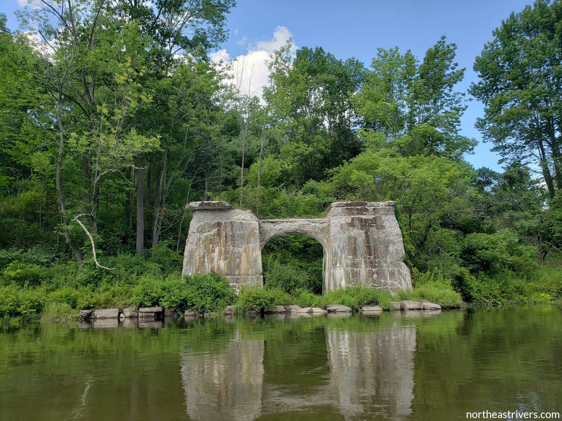
| 0.0 | The West Branch meets the East Branch to form the beautiful, free-flowing, 330.2-mile long Delaware River. | confluence pic |

Access points
| River mile | Access (key) | Position | Nearest town | Type/condition | Links |
|---|---|---|---|---|---|
| 16.0 | Laurel Bank Ave (Rt 48) | L | Deposit, NY | map | |
| 14.5 | Wastewater Treatment Plant | U/R | Deposit, NY | average steep grass/gravel/mud shore | map |
| 14.3 | Norbord access | D/L | Deposit, NY | map | |
| 13.6 | Airport Rd upstream | L | Deposit, NY | average grass/mud/gravel shore; swift current | pic | map |
| 12.8 | Airport Rd downstream | L | Deposit, NY | good gravel ramp | map |
| 9.7 | Sherman Creek Rd (Rt 4/56) | U/L | Hale Eddy, NY | average rock shore | pic | map |
| 4.7 | Balls Eddy |
R | Autumn Leaves, PA | good concrete ramp; good gravel shore | pic | map |
| 1.3 | Outdoor Adventure Recreational Services (OARS) * | U/L | Hancock, NY | good gravel ramp; swift current | pic | map |
| 0.5 | Shehawken Creek |
R | Autumn Leaves, PA | excellent concrete ramp | pic | map |
River gauges
| Station | River mile | Data and forecasts | Recommended level |
|---|---|---|---|
| West Branch Delaware River at Stilesville *~^ | 17.0 | USGS | NWS | |
| West Branch Delaware River at Hale Eddy ^ | 9.7 | USGS | NWS | at least 3.0 ft |
~ directly affected by reservoir operations
^ water temperature data available
The New York City Department of Environmental Protection (DEP) operates Cannonsville Dam under the direction of the Delaware River Basin Commission (DRBC) and the Delaware River Master. Reservoir levels and releases are published online and are updated weekday mornings. The DEP does not forecast reservoir releases, but the likelihood of a release level being sustained or increased/decreased can be estimated by comparing the system’s current percent capacity to the normal percent capacity (the DRBC hydrologic conditions dashboard offers a neat visual representation of this at upper-right). Announcements of unusual dam operations can be found on NYC Watershed’s Facebook page.
Additional resources
Paddling outfitters: OARS
Guidebooks: Keystone Canoeing (Hale Eddy to mouth)
West Branch Delaware River fishing map


See also: Delaware River watershed | East Branch Delaware River | Upper Delaware River