


Recent trips
16-Jul-2022: Juniata River
15-Jul-2022: Juniata River
14-Jul-2022: Juniata River
13-Jul-2022: Juniata River
30-Jun-2022: Delaware River
29-Jun-2022: Delaware River
28-Jun-2022: Delaware River (night)
14-Jun-2022: East Branch Delaware River
13-Jun-2022: Susquehanna River
Staged river passage: Tidal Delaware River
30-May-2022: Delaware River Day 1*
31-May-2022: Delaware River Day 2*
01-Jun-2022: Delaware River Day 3*
02-Jun-2022: Delaware River Day 4*
24-May-2022: Tioughnioga River
21-May-2022: East Branch Delaware River
13-May-2022: Allegheny River
11-May-2022: Delaware River
09-May-2022: Tioga River
05-May-2022: Otselic and Tioughnioga Rivers
24-Apr-2022: Canisteo River
Staged river passage: Tidal Delaware River
12-Apr-2022: Delaware River Day 1*
13-Apr-2022: Delaware River Day 2*
14-Apr-2022: Delaware River Day 3* (snafu)
02-Apr-2022: Chemung River
18-Mar-2022: East Branch Delaware River
16-Mar-2022: Chemung River
16-Jul-2022: Juniata River
River Rd, McVeytown to Victory Park, Lewistown
15.5 miles in 5:46 (2.7 mph)
2 ft/mile; class I-
Juniata River at Lewistown: steady at 3.1 ft (low)
Weather: pleasantly mild to cool in rain; overcast with some breaks early and late; a heavy shower around 1045 preceded by light rain and another light shower around 1230; variable winds associated with showers, otherwise calm


15-Jul-2022: Juniata River
Central Juniata Park, Mifflin to Greenwood access, Millerstown
18.1 miles in 6:57 (2.6 mph)
2 ft/mile; class I
Juniata River at Newport: steady at 3.5 ft (low)
Weather: pleasantly mild becoming very warm; mostly sunny; light and variable wind


14-Jul-2022: Juniata River
Greenwood access, Millerstown to Amity Hall access, Duncannon
13.8 miles in 5:14 (2.6 mph)
3 ft/mile; class I
Juniata River at Newport: steady at 3.6 ft (low)
Weather: very hot in full sunlight, otherwise warm; mostly sunny becoming partly to mostly cloudy; intermittent light northwest wind


13-Jul-2022: Juniata River
Victory Park, Lewistown to Central Juniata Park, Mifflin
12.7 miles in 4:27 (2.9 mph)
3 ft/mile; class I
Juniata River at Lewistown: 3.3 ft falling to 3.2 ft (low)
Weather: very warm when sunny and calm, pleasantly warm when cloudy or breezy; partly cloudy with slight haze; light southwest wind


30-Jun-2022: Delaware River
Milford Beach, Milford to Eshback access, Pine Ridge
14.7 miles in 4:37 (3.2 mph)
3 ft/mile; class I
Delaware River at Montague: 6.0 ft falling to 5.7 ft (moderately low)
Weather: warm to very warm; mostly sunny; light northwest wind with moderate gusts


29-Jun-2022: Delaware River
Smithfield Beach, Winona Lakes to Portland-Columbia Pedestrian Bridge, Portland
10.6 miles in 3:43 (2.9 mph)
2 ft/mile; class I+
Delaware River near Delaware Water Gap: steady at 6.3 ft (moderately low)
Weather: warm; partly cloudy; moderate southwest wind becoming lighter late


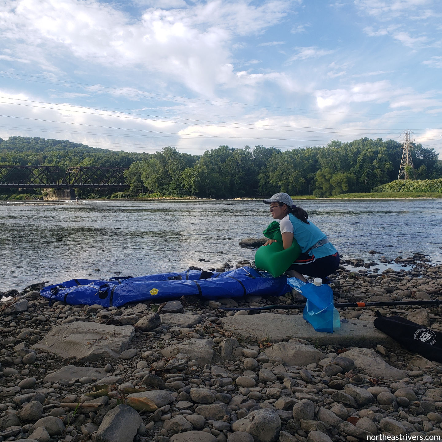
28-Jun-2022: Delaware River (night)
Poxono access, Hardwick Twp to Kittatinny Point, Warrington via mile 211.0
8.9 miles in 3:02 (2.9 mph)
2 ft/mile; class I
Delaware River near Delaware Water Gap: steady at 6.3 ft (moderately low)
Weather: pleasantly cool; mostly clear to partly cloudy with stars visible through the cloud layer; no fog and not overly damp; calm wind
BLAH.
14-Jun-2022: East Branch Delaware River
Harvard Rd, East Branch to Firemans Field, Hancock
15.3 miles in 4:31 (3.4 mph)
7 ft/mile; class II-
East Branch Delaware River at Fishs Eddy: steady at 5.3 ft (moderately low)
Weather: pleasantly warm; mostly sunny; light northwest wind with up to moderately strong gusts


13-Jun-2022: Susquehanna River
Council Rock Park, Cooperstown to Rt 166, Milford
12.8 miles in 5:19 (2.4 mph)
~2 ft/mile excluding dam; class I-
Susquehanna River at Unadilla: steady at 3.1 ft (low)
Weather: pleasantly warm; partly cloudy becoming mostly sunny with beautiful cirrus clouds; light but gusty northwest wind


30-May-2022: Delaware River Day 1*
Beach Ave, Woodland Beach to Collins Landing, Woodland Beach (Cedar Swamp inlet)
5.0 miles in 2:01 (2.5 mph)
0 ft/mile (tidal); class A
Delaware Bay at Ship John Shoal: high tide at 1048
Weather: pleasantly warm and somewhat humid; sunny with a little cirrus; calm becoming intermittent light south wind


31-May-2022: Delaware River Day 2*
Port Mahon access, Little Creek (Mahon River) to Beach Ave, Woodland Beach
10.0 miles in 6:08 (1.6 mph)
0 ft/mile (tidal); class A
Delaware Bay at Ship John Shoal: high tide at 1130
Weather: pleasantly warm becoming very hot; sunny; occasional light northwest wind early, then calm


01-Jun-2022: Delaware River Day 3*
Bowers Beach, Bowers (Murderkill River) to Port Mahon access, Little Creek (Mahon River)
8.5 miles in 4:17 (2.0 mph)
0 ft/mile (tidal); class A
Delaware Bay at Ship John Shoal: high tide at ~1210
Weather: warm and humid early with a light north wind, then pleasantly mild after a rapid shift to a light to moderate east-southeast wind; mostly sunny


02-Jun-2022: Delaware River Day 4*
Lighthouse Rd, Slaughter Beach (Cedar Creek) to Bowers Beach, Bowers (Murderkill River)
8.6 miles in 4:49 (1.8 mph)
0 ft/mile (tidal); class A
Delaware Bay at Brandywine Shoal Light: high tide at ~1143
Weather: pleasantly cool and damp early with gradually thinning fog; overcast breaking mid-trip to give mostly sunny skies and pleasantly warm temperatures; periods of light southeast/northeast wind with long calm stretches


24-May-2022: Tioughnioga River
Yaman Park, Cortland (East Branch Tioughnioga River) to Hunts Creek, Marathon
14.5 miles in 4:57 (2.9 mph)
5 ft/mile; class I-
Tioughnioga River at Cortland: steady at 3.4 ft (low)
Weather: pleasantly mild when sunny and calm, otherwise pleasantly cool; mostly sunny becoming mostly cloudy; light to moderate and gusty southeast wind


21-May-2022: East Branch Delaware River
Covered Bridge Park, Downsville to Oxbow Campsites, Harvard
13.1 miles in 4:44 (2.8 mph)
6 ft/mile; class II-
East Branch Delaware River at Harvard: steady at 2.9-3.0 ft (low)
Weather: very warm and humid with occasional pockets of cool air; mostly sunny and hazy; light southwest wind with moderate gusts late


13-May-2022: Allegheny River
Champlin Hill Rd, Turtlepoint to Rt 346, Eldred
13.7 miles in 4:45 (2.9 mph)
1 ft/mile; class A
Allegheny River at Eldred: 5.2 ft falling to 5.1 ft (moderate)
Weather: pleasantly warm; partly to mostly cloudy; light southeast wind


11-May-2022: Delaware River
Ferry St, Long Eddy to Cochecton Turnpike, Damascus
16.5 miles in 5:27 (3.0 mph)
6 ft/mile; class I+
Delaware River at Callicoon: steady at 3.6 ft (moderately low)
Weather: pleasantly mild; sunny with a few clouds to the south; light southeast wind with moderate gusts


09-May-2022: Tioga River
Main St, Tioga to Glendening Creek, Presho
16.3 miles in 5:07 (3.2 mph)
5 ft/mile; class I-
Tioga River at Tioga Junction: steady at 7.8 ft (low)
Weather: pleasantly mild to pleasantly warm; brilliantly sunny; light northeast wind


05-May-2022: Otselic and Tioughnioga Rivers
Dorchester Park, Whitney Point to Rt 12, Chenango Forks
11.5 miles in 3:31 (3.3 mph)
5 ft/mile (excluding dam); class I-
Tioughnioga River at Itaska: steady at 3.1 ft (moderate)
Weather: pleasantly mild; mostly sunny through a thin layer covering the sky; very light north wind


24-Apr-2022: Canisteo River
Rt 119, West Cameron to Tuscarora Creek, Addison
16.6 miles in 5:43 (2.9 mph)
6 ft/mile; class I
Canisteo River at West Cameron: steady at 4.5 ft (moderately low)
Weather: pleasantly cool becoming pleasantly warm; mostly sunny; calm to light southeast wind shifting to southwest in the afternoon


12-Apr-2022: Delaware River Day 1*
Fort DuPont State Park, Delaware City (C&D Canal, Delaware City Branch Channel) to Augustine Beach, Port Penn
5.2 miles in 2:00 (2.6 mph)
0 ft/mile (tidal); class A
Tidal Delaware River at Reedy Point: low tide at 1539
Weather: pleasantly mild to pleasantly cool; mostly sunny; moderate northwest wind


13-Apr-2022: Delaware River Day 2*
Augustine Beach, Port Penn to Collins Landing, Woodland Beach (Cedar Swamp inlet)
8.3 miles in 4:31 (1.8 mph)
0 ft/mile (tidal); class A
Tidal Delaware River at Reedy Point: high tide at 0915
Weather: pleasantly cool; mostly cloudy and hazy with weak sunshine through a thin translucent layer; intermittent light southeast wind becoming steady late


14-Apr-2022: Delaware River Day 3* (snafu)
Beach Ave, Woodland Beach to Beach Ave, Woodland Beach via mile 42.9
1.3 miles in 1:42 (0.8 mph)
0 ft/mile (tidal); class A
Delaware Bay at Ship John Shoal: high tide at 0854
Weather: pleasantly mild; mostly sunny; strong west-southwest wind with very strong gusts on open river, light wind with moderate gusts near shore
Preoccupied with keeping my boat stable and vaguely moving in the intended direction, I didn’t even manage to take five photos. For a write-up on this snafu of a trip, see How I plan tidal river trips, or, Woodland Beach to Woodland Beach.
02-Apr-2022: Chemung River
Wastewater Treatment Plant, Painted Post (Cohocton River) to Fitch’s Bridge, West Elmira
15.5 miles in 3:54 (4.0 mph)
5 ft/mile; class I-
Chemung River at Corning: 17.0 ft falling to 16.7 ft (high)
Weather: chilly; sunny with a few high thin clouds, especially late; light and variable wind


18-Mar-2022: East Branch Delaware River
Covered Bridge Park, Downsville to Tomannex State Forest, Harvard
11.9 miles in 3:40 (3.2 mph)
7 ft/mile; class II- (I)
East Branch Delaware River at Harvard: steady at 3.7 ft (moderate)
Weather: pleasantly mild becoming cool in shadow late; sunny; light and variable wind


16-Mar-2022: Chemung River
Kinsella Park, Painted Post (Cohocton River) to Bottcher’s Landing, Big Flats
10.4 miles in 2:08 (4.9 mph)
5 ft/mile; class I-
Chemung River at Corning: steady at 18.6-18.7 ft (very high)
Weather: pleasantly cool when calm and sunny, otherwise cool; mostly sunny with slight haze; light to moderate south wind with moderate gusts, especially early


Archived trips
Nothing to see here yet…
See also: Home | Rivers list